|
The 2006 Hunt !

2007 BEAR
We were recently on a
backpacking trip in the Weminuchie Wilderness. We saw a few bears on the trip.
When we returned to our vehicle there were bear paw prints all around our
vehicle. We thought it was a great shot."


HuntData LLC
For Sales please Call.
303.663.4878
For support questions, please send us an email
the response will be much faster.

|
|
| |
|
|
 |
 |
|
Concentration Area Definitions |
BLM Land Status Map Legend |
|
|

 |

 |
|
|
|
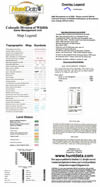
Resident Population
An area
used year-round by a population of elk.
Individuals could be found in any part of
the area at any time of the
year; the
area cannot be subdivided into seasonal
ranges. It is most likely included within
the overall range of the
larger
population. Not all units have a resident
population.
Summer Concentration
Those
areas where elk concentrate from mid-June
through mid-August. High quality forage,
security, and lack of
disturbance are characteristics of these
areas to meet the high energy demands of
lactation, calf rearing, antler
growth,
and general preparation for the rigors of
fall and winter.
Summer Range
That part
of the range of a species where 90% of the
individuals are located between spring
green-up and the first
heavy
snowfall. Summer range is not necessarily
exclusive of winter range; in some areas
winter range and summer
range may
overlap.
Winter Range
That part
of the overall range of a species where 90
percent of the individuals are located
during the average five
winters
out of ten from the first heavy snowfall to
spring green-up.
Winter Concentrations
That part
of the winter range of a species where
densities are at least 200% greater than the
surrounding winter range
density
during the same period used to define winter
range in the average five winters out of
ten.
Severe Winter Range
That part
of the range of a species where 90 percent
of the individuals are located when the
annual snowpack is at its
maximum
and/or temperatures are at a minimum in the
two worst winters out of ten. The winter of
1983-84 is a good
example
of a severe winter.
Migration Corridor
A
specific area through which large numbers of
animals migrate and loss of which would
change migration routes.
Production Area
That part
of the overall range of elk occupied by the
females from May 15 to June 15 for calving.
Where did the map data come from?
The
Natural Diversity Information Source, NDIS,
a Division of the Colorado Division of
Natural Resources. NDIS
has an
ongoing study with over 12 years of
continuous monitoring and tracking wildlife.
The concentration maps are
updated
on a 5 year cycle.
|
|
 |
 |
 |
 |
 |
|
|
| |
home |
about us |
products | search | checkout
| e-mail
| privacy policy
HuntData Copyright 1996-2007 HuntData LLC.
Web site Optimization and Design By fmtmwebservices.net
& Uswebtek.com
|
|
|

New Products

|

View more 3DEM Maps

|

Testimonials

|
|


