|
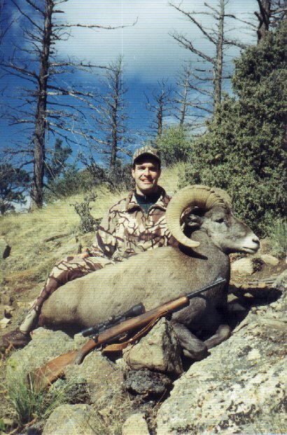
The Hunt !
2008

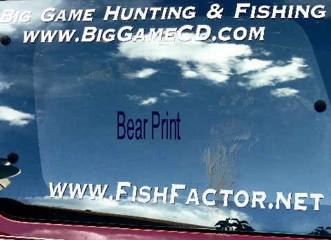
2007 BEAR
We were recently on a
backpacking trip in the Weminuchie Wilderness. We saw a few bears on the trip.
When we returned to our vehicle there were bear paw prints all around our
vehicle. We thought it was a great shot."


HuntData LLC
For Sales please Call.
303.663.4878
For support questions, please send us an email
the response will be much faster.
|
|
| |
|
|
 |
|
|
Land Status Maps
|
|
|
The latest BLM Land Status maps are
great tools for determining what lands are public and
private. Once you have your hunt camp located, the maps
area great for charting your course. The maps display
Forest Road, BLM Road and other public road ways as well
as trail systems. Now, take all of this knowledge and
project it in a HuntData 7.0 or Google Earth.

 |
|
 |
|
Satellite Maps
The Digital Maps contain a NASA
Land SAT Satellite image. These images allow us to
create the “Wow!” effects from JMU. The 8 meter
resolution images are color photos taken between 2001
and 2002. Projecting these photos over Unit Digital
Elevation Models creates a realistic depiction of the
unit terrain. Act like your at the controls of a
helicopter, climbing ridges you would like to someday
explore and recognizing terrain you’ve hunted for
years. The satellite images place you in your unit from
angles never before possible.
|
|
Click on the
pictures to load the movie |
Click on the
pictures to load the movie |
|
For Dialup speed please use this link.
 |
|
For DSL speed please use this link. |
|
Satellite Fly Through |
Satellite Rotate |
|
|
|
|
Elk Concentration Maps
The elk concentration maps display
overlays of Summer, Winter, and Spring concentration
areas. These maps are great tools for
identifying the areas most likely to hold animals during
your hunt. The Digital Maps will project the elk concentration map
in a 3D model for your exploration and inspection.
>>>> Map Legends
Tab
|
|
Topographical Maps
The Digital
Maps also
contains a 1;100,000 base
topographical map from the USGS. The maps are similar
to the maps contained in many popular mapping packages.
|
|
|
 |
|
 |
|
|
|
| |
home |
about us |
products | search | checkout
| e-mail
| privacy policy
HuntData Copyright 1996-2007 HuntData LLC.
Web site Optimization and Design By fmtmwebservices.net
& Uswebtek.com
|
|
|

New Products
|

View more 3DEM Maps
|
Testimonials
|
|