|
The 2006 Hunt !

2007 BEAR
We were recently on a
backpacking trip in the Weminuchie Wilderness. We saw a few bears on the trip.
When we returned to our vehicle there were bear paw prints all around our
vehicle. We thought it was a great shot."


HuntData LLC
For Sales please Call.
303.663.4878
For support questions, please send us an email
the response will be much faster.
|
|
| |
| |
 |
|
|
Saving and Using
BigGameCD Maps in Google Earth! |
|
Click on the “Steps” to view an instructional
screen shot |
|
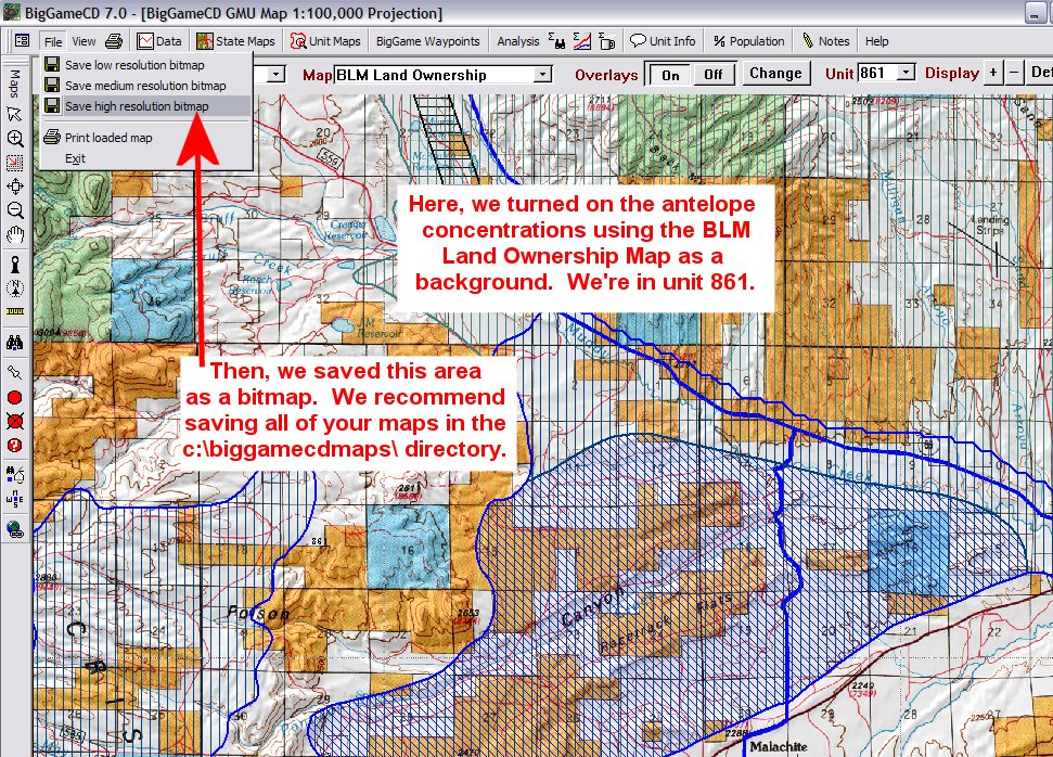
Step 1 |
Create your map in BigGameCD
7.0. Zoom into your subject area and Save a high
resolution image. We recommend saving the image in
the C:\BiggameCD\ directory. Make a note of the
type of map used as your background (Land Ownership,
Topo, Satellite, Shaded Relief) and the Unit your
area is in. |
|
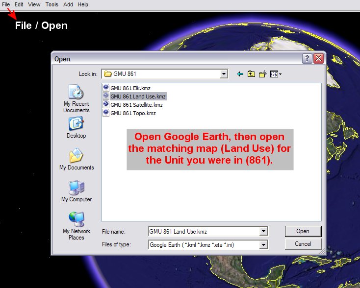
Step 2 |
Open Google Earth. Select the
Unit map matching your background map. In our
example, we created an antelope concentration map in
unit 861. In Google Earth, we would open the GMU
861 Land Use.kmz file. |
|
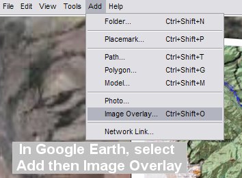
Step 3 |
In Google Earth, select “Add”
then “Image Overlay” |
|
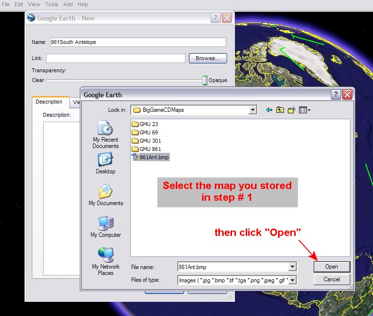
Step 4 |
Select the map you saved in
Step 1 above. You may need to change the “Files of
Type” selection to “All” in order to see your map.
Highlight the map and click “Open” |
|
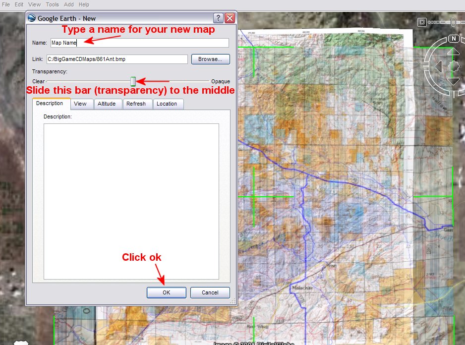
Step 5 |
Google Earth will project your
new map over the map you opened in Step 2. Type in
a name for your new map, it can be the same as your
stored map. Then, slide the Transparency bar to the
middle. Click “Ok” |
|
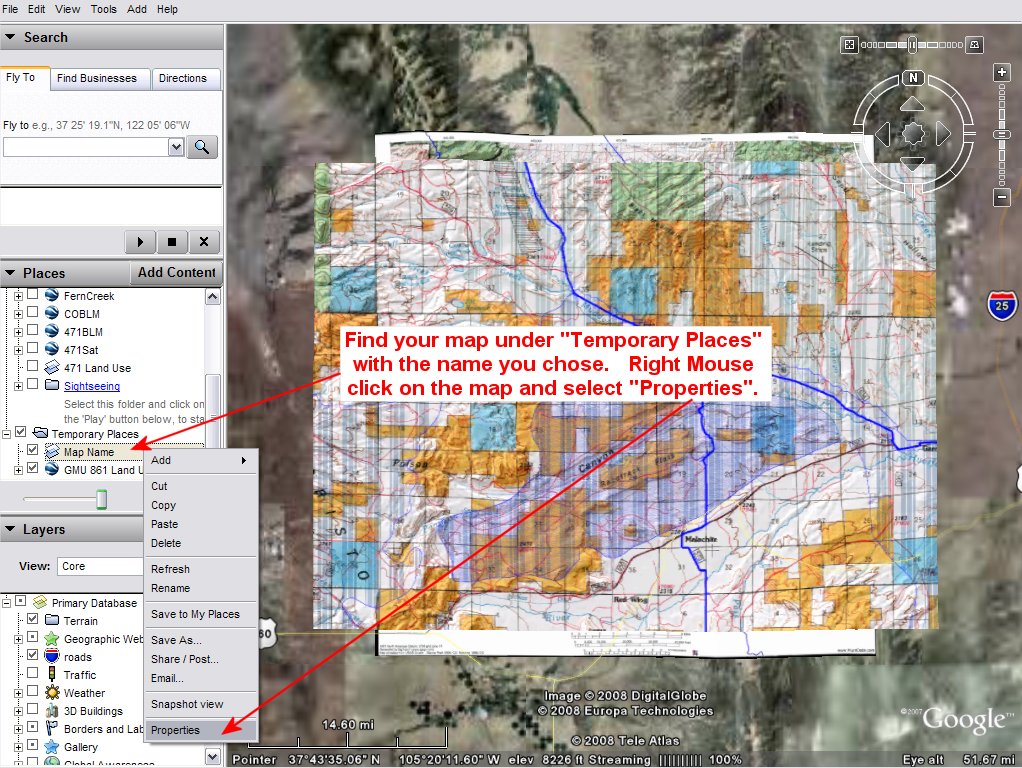
Step 6 |
Find your map in the “Places”
section under “Temporary Places”. It will have the
name you gave it in Step 5 above. Right Mouse
click on the map and choose “Properties”. |
|
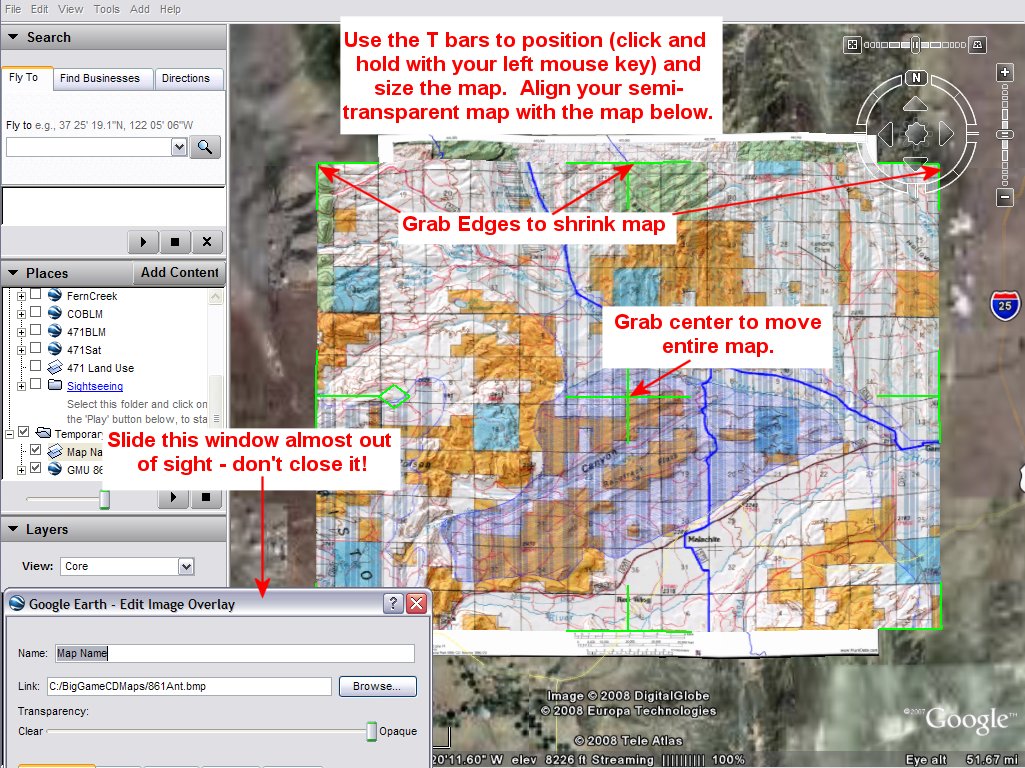
Step 7 |
The “Edit Image Overlay” box
will appear. Slide this box down to the bottom of
the screen almost out of sight. Then, adjust the
image (now semi-transparent) to match the map
below. Align roads, unit boundaries, or other land
marks. Adjust the image by grabbing the green “T”
bars along the edges. Grab the Center + bar to move
the whole image. You can zoom in and zoom out
using the left and right mouse buttons. |
|
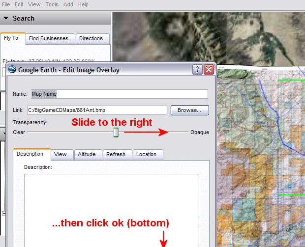
Step 8 |
Once your map matches, move the
“Edit Image Overlay” Window back up and slide the
Transparency bar completely to the right. |
|
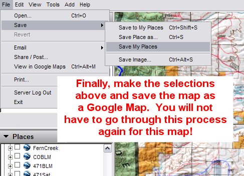
Step 9 |
Choose File, Save, then “Save
My Places”. Save the map under your chosen name or
another name. Again, we recommend saving this map
in the c:\BigGameCD\ directory. |
|
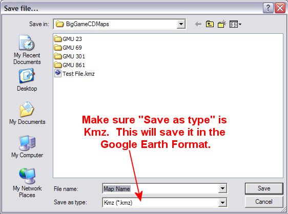
Step 10 |
When saving the Google Image,
make sure the “Save as Type” selection is .Kmz.
This is the Google File format. |
|
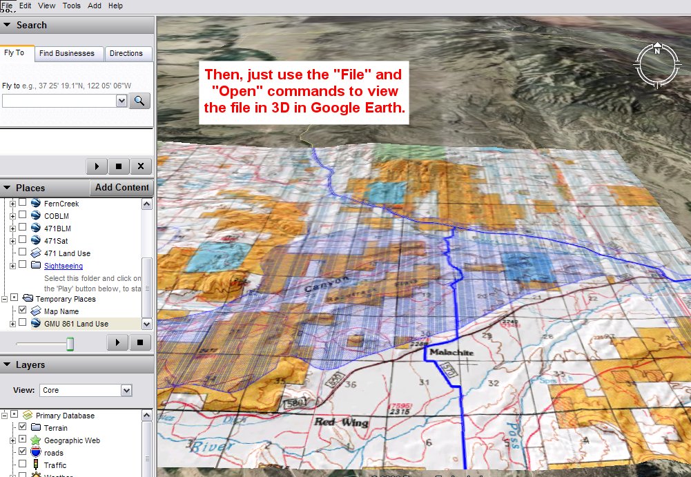
Step 11 |
You can now re-open the map in
Google Earth’s 3D viewer. You only need to perform
these steps once for a map. After you have saved
the map you simply select “File” and “Open” to view
the map in Google Earth. |
|
|
|
 |
|
 |
|
|
|
| |
home |
about us |
products | search | checkout
| e-mail
| privacy policy
HuntData Copyright 1996-2007 HuntData LLC.
Web site Optimization and Design By fmtmwebservices.net
& Uswebtek.com
|
|
|
|


