HuntData LLC For Sales please Call. 303.663.4878
For support questions, please send us an email the response will be much faster.
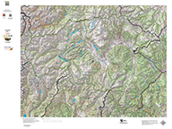
CO Mule Deer GMU Topo Maps.
Details
We redesigned our Topo series this year adding updated roads from the USGS 7.5 minute map series to the 1:100, 000 Topo base. Click on the small map at left to see a larger sample. Scroll to the bottom of the map to order then move to the bottom right to Add To Cart. We also enhanced the Forest Service boundries. The result is a traditional topo map with current info! A great tool for your hunt. Click Here to see the Statewide GMU Reference Map.
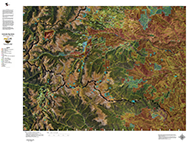
CO Hybrid Satellite Images with Mule Deer and Elk Concentrations.
An enhanced satellite images with roads and trails fron the USGS 7.5 minute Quad maps and Mule Deer Summer and Winter Concentration Areas. Click on the small image at left for a much larger sample.
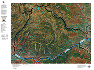
NEW! Satellite with Land Ownership AND Elk Concentrations.
NEW! This map takes 6 different software programs to develop. We use an enhanced set of Satellite Images, project Land Ownership, shading private in red, then add elk summer, winter, resident herd and migration data. This map is good enough to hang on the wall! We print it all on our rugged map fabric for an heirloom quality map. You will study this map for hours!
Colorado Satellite Unit Maps with Land Ownership.
An enhanced satellite image with Land Ownership Boundaries. You will study this map for hours! All printed on our rugged cloth fabric. You will love it!
Colorado Statewide BLM BigGame Unit Map with Land Status.
Base 1:500,000 BLM Land Ownership with Colorado DOW GMU Boundaries. Its a great wll-hanger, about 3ft. by 4ft. Great for the garage, the den, or the shop. You will see this map displayed in DOW Offices around the State. Click Here for a brochure about different map scales.
Custom Colorado Whitetail Deer Concentration Maps.
1:100,000 Land Ownership Maps with Whitetail Deer Concentration Overlays.
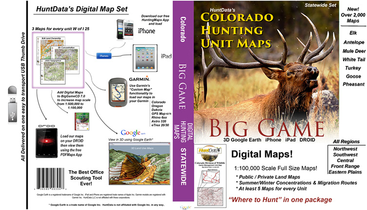
Digital Maps - Co Statewide.
Digital Maps - Colorado State Map Set.
home | about us | products | search | checkout | e-mail | privacy policy
HuntData Copyright 1996-2008 HuntData LLC. Web site Optimization and Design By fmtmwebservices.net & Uswebtek.com