Just My UnitProducts


HuntData LLC
For Sales please Call.
303.663.4878


For support questions, please send us an email the response will be much faster.


Home » Colorado » Colorado Statewide Digital Maps  
Digital Maps - Colorado State Map Set

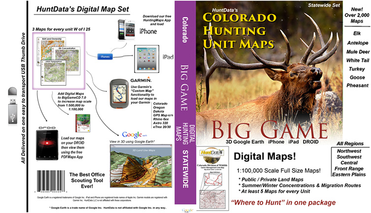
Digital Maps - Colorado State Map Set.

Details 

Statewide Maps! Get 1500 Custom GMU Maps, 5 maps for every unit in the State including the Eastern Plains units. Open them all in 3D using Google Earth!!!!!

Check out our Digital Maps - Statewide = West of I25. HuntData's Digital Maps are viewable in BigGameCD 7.0 - OR - Google Earth (Mac & PC) Explain and other commercial mapping packages capable of processing GeoTiff files. These maps are a must of the Colorado hunter in locating the concentration of the elk and determining if the land is public. Also included are the NASA Satellite images at a 1/100,000. An invaluable tool for hunters who want to better navigate in their GMU. Click on 'Details' on the right for more info and examples.

Statewide Options:
Price: $0.00


Note: If you are unable to add items to your cart please make sure you are able to accept Session "cookies" in your browser.


home | about us | products | search | checkout | e-mail | privacy policy

HuntData Copyright 1996-2008 HuntData LLC.
Web site Optimization and Design By fmtmwebservices.net  & Uswebtek.com