Just My UnitProducts


HuntData LLC
For Sales please Call.
303.663.4878


For support questions, please send us an email the response will be much faster.


Home » Colorado » Colorado Mountain Goat Unit Maps  
CO Mountain Goat 3 Printed Map Combo, Save $40

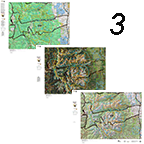
CO Mountain Goat 3 Printed Map Combo, Save $40.

Details 

Get all 3 great maps. The Land Ownership and Satellite Maps display color coded kill sites and concentrations. The Topo map provides a traditional map view with Unit Boundaries for clear navigation.

CO_Mountain Goat Printed Map:
Add Digital Maps:
Price: $89.95

CO Mountain Goat Kill Sites with Land Ownershp and Concentration

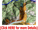
CO Mountain Goat Kill Sites with Land Ownershp and Concentration.

Details 

Kill sites color coded by year with concentration areas all projected on a land ownership map. We build the maps from the bottom up each year to ensure the most accurate data possible. We include the roads and trails from the USGS 7.5 minute Quad series. The most detailed roads available.

CO_Mountain Goat Printed Map:
Add Digital Maps:
Price: $49.95

CO Mountain Goat Kill Sites, Concentrations over Satellite

CO Mountain Goat Kill Sites, Concentrations over Satellite.

Details 

Kill sites color coded by year with concentration areas all projected on a satellite image. We include the USGS road and trail system from their 7.5 minute Quad maps as well.

CO_Mountain Goat Printed Map:
Add Digital Maps:
Price: $49.95

CO Mountain Goat Topo with Concentrations

CO Mountain Goat Topo with Concentrations.

Details 

We created custom Topo maps built from the ground up. The maps display the traditional topo view with contour lines and green vegetation shading. We add National Forest and Federal Lands outlines as well.

CO_Mountain Goat Printed Map:
Add Digital Maps:
Price: $39.95

COMBO: CO Mtn Goat Printed and Digital Images

COMBO: CO Mtn Goat Printed and Digital Images.

Details 

Select 2 or all 3 products - all with plotted kill sites. Printed Land Use Unit Map, Printed Satellite Image, Digital 3D Map Sets.

Mountain Goat 3D Map Combo:
Goat Combinations:
Price: $0.00

CO Mountain Goat Custom Centerpoint 7.5 Minute Maps

CO Mountain Goat Custom Centerpoint 7.5 Minute Maps.

Details 

Centerpoint maps are custom 7.5 Minute USGS Topo Maps. We'll generate the most detailed topo map available and plot the kill sites for Mountain Goats. Click on the map image at left for more details.

Enter your Colorado Coordinates:
COGoatCenterpoint Surface Selection:
Price: $0.00

CO Mountain Goat 3D Google Maps!

CO Mountain Goat 3D Google Maps!.

Details 

3D Google Earth maps of any Mountain Goat Unit! The maps are exact copies the printed map. Transfer coordinates and make notes on an exact 3D image of your paper map. The maps display kill sites and reported kill drainages from 2003 through last Fall. Kill Sites are color coded by year! Click Here to see a Google Earth demo.

Mountain Goat 3D Map:
Price: $39.95


Note: If you are unable to add items to your cart please make sure you are able to accept Session "cookies" in your browser.


home | about us | products | search | checkout | e-mail | privacy policy

HuntData Copyright 1996-2008 HuntData LLC.
Web site Optimization and Design By fmtmwebservices.net  & Uswebtek.com