HuntData LLC For Sales please Call. 303.663.4878
For support questions, please send us an email the response will be much faster.
CO Satellite Eastern Plains, Walk-in, Pheasant, Turkey, Goose.
Details
Its time for pheasant and goose season. Our new Satellite Images for the Eastern Plains Units (E of I25) display walk-in access areas, State Wildlife Areas, State Lands, National Grasslands, and BLM areas. In addition, we have concentration areas for Pheasant, Goose, and Turkeys!
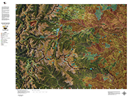
Colorado Satellite Unit Maps with Land Ownership.
An enhanced satellite image with Land Ownership Boundaries. You will study this map for hours! All printed on our rugged cloth fabric. You will love it!
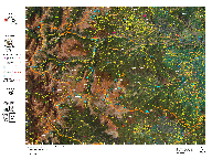
Colorado Satellite Unit Maps with Elk Concentrations.
An enhanced satellite image with Elk Concentrations. You will study this map for hours! All printed on our rugged cloth fabric. You will love it! Click on the image at left for a much larger sample.
Colorado Hybrid Satellite Unit Maps with Land Ownership and Elk Concentrations.
An enhanced satellite image with Land Ownership Boundaries and Elk Concentrations. You will study this map for hours! All printed on our rugged cloth fabric. You will love it!
home | about us | products | search | checkout | e-mail | privacy policy
HuntData Copyright 1996-2008 HuntData LLC. Web site Optimization and Design By fmtmwebservices.net & Uswebtek.com